88 Olliers Road, Mount Rowan
88 Olliers Road, Mount Rowan
Rezone + Development: 88 Olliers Rd Mount Rowan – 60HA 860 Lots –FZ to GRZ – Rezone Pending.
Site Background
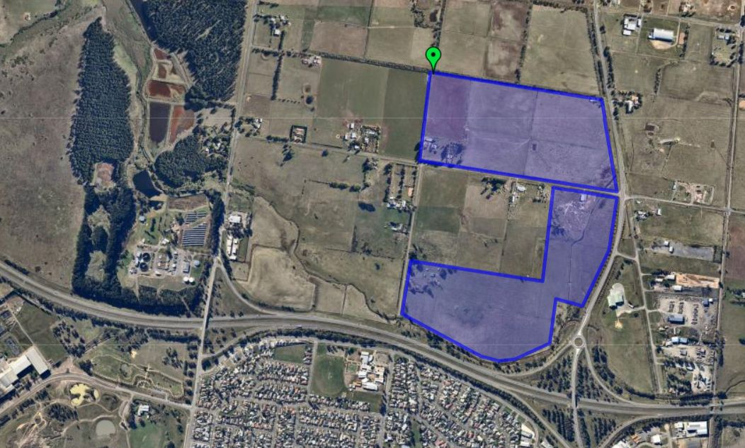
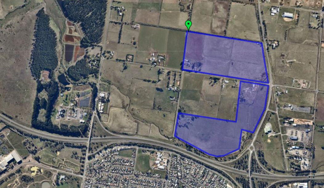
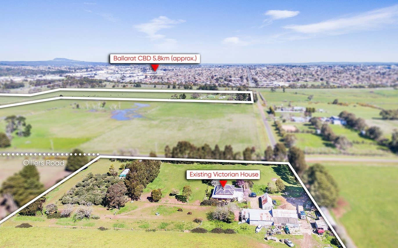
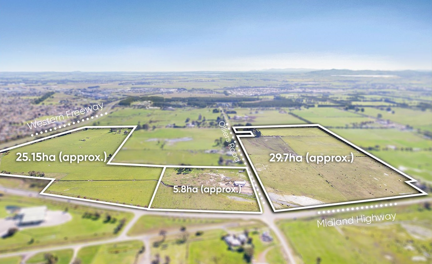
The site is located at Olliers Road, Mount Rowan, approximately five kilometers north of the Ballarat CBD, north-west of the intersection of the Western Freeway and Midland Highway. The site is approximately 60.5 hectares in size and comprises three parcels.
The site is predominantly zoned Farming Zone and used for farming purposes (grazing). A small part of the site at the eastern edge is zoned Industrial 1 Zone.
The site is generally flat and clear of vegetation. The site adjoins farming land to the north (owned by Ballarat Grammar), the Midland Highway to the east, the Western Freeway to the south and smaller farming properties/lifestyle blocks to the west. The Western Treatment plant is located approximately 800m to the west of the site.
The sites were purchased in December 2019.
Planning
The City of Ballarat prepared Today, Tomorrow Together: The Ballarat Strategy in 2015 to provide a vision and long term plan to manage change in Ballarat to 2040. The Ballarat Strategy nominated three Greenfield Investigation Areas (GIA) to the north, east and west of the city for further investigation, to determine their suitability to accommodate Ballarat’s long-term growth. The site is located within the Northern GIA.
In January 2016, Ballarat City Council prepared the Ballarat Long-Term Growth Options Investigation which assessed the Eastern, Western and Northern GIA’s and identified the Northern GIA as the preferred long-term growth area for Ballarat. Whilst this investigation was underway, Council was simultaneously progressing a planning scheme amendment (Amendment C194) to implement the recommendations of the Ballarat Strategy (including identification of the three potential GIA’s) into the Ballarat Planning Scheme.
The Ballarat Long-Term Growth Options Investigation was reviewed and updated in 2018 to consider the north-western GIA. The 2018 version of the report used multi-criteria assessment to assess the suitability of the four GIA’s based on a range of key principles including serviceability, proximity to CBD, proximity to employment etc.
The Northern GIA scored well ahead of the other GIA’s and consequently was recommended as the preferred location for Ballarat’s future growth and also to function as a new/second growth front to complement the existing growth area in Ballarat West. This would have the benefit of creating choice and competition within Ballarat’s housing market.
The recommendations of the Ballarat Long-Term Growth Options Investigation 2018 report were effectively endorsed by Council on 30 October 2019 when Council resolved to seek authorization from the Minister for Planning to commence a planning scheme amendment to identify the Northern GIA, followed by the Western GIA, as Ballarat’s next urban growth area.
At its ordinary Council meeting, 16 September 2020, Council resolved to progress with planning for two new greenfield growth fronts, in the west of the city and to the north around Mount Rowan by partnering with landowners to prepare and complete the Precinct Structure Plans and associated controls.
Yield
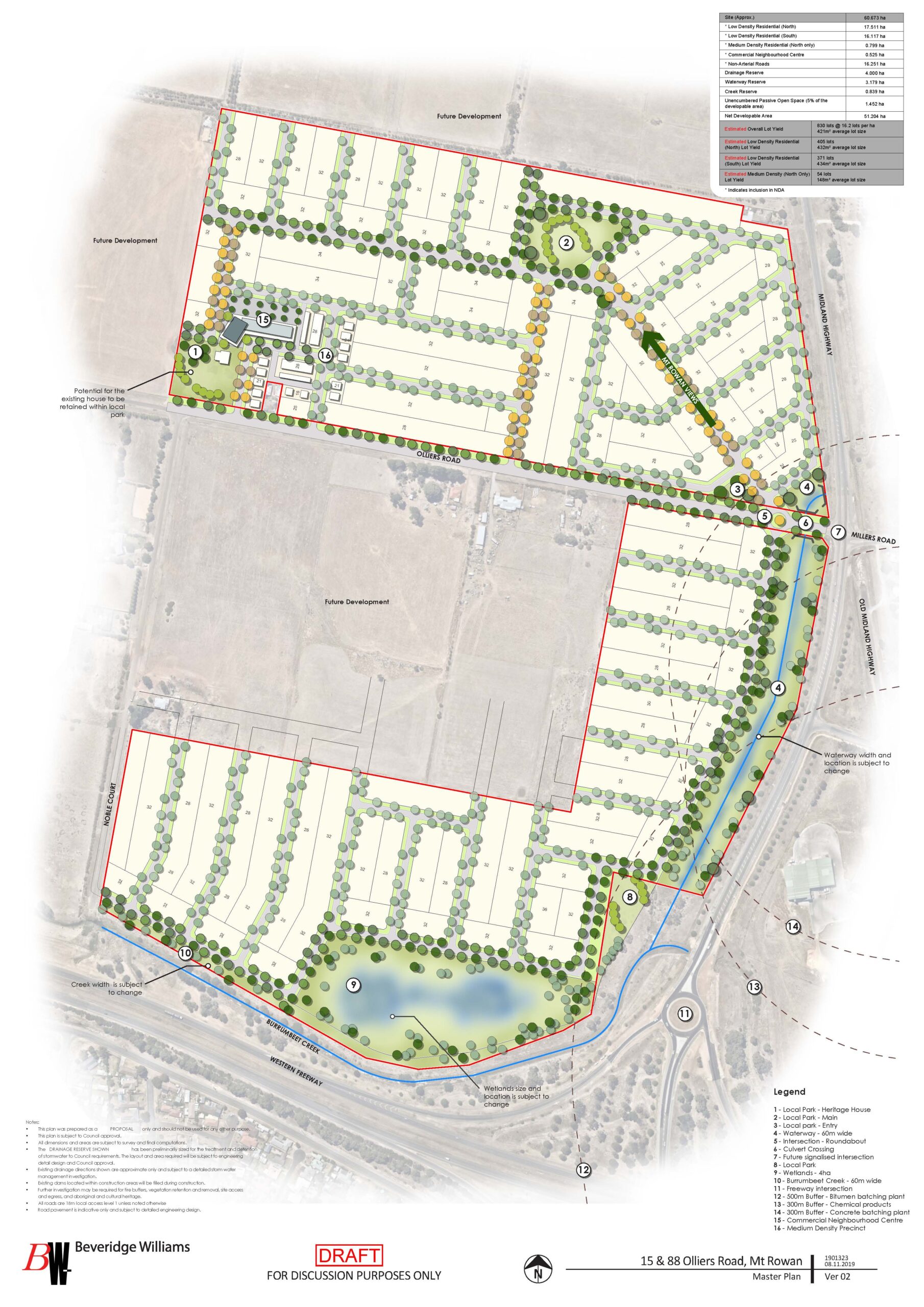
As per the Urban Structure Plan, commissioned by Beveridge Williams, the determined yield was for a residential development providing a yield of 830 allotments and 34.94 Hectares of Net Saleable Area. The masterplan for the development includes multiple local parks, wetlands, parkland abutting Burrumbeet Creek and a Neighborhood Commercial Centre.
Status
The property currently provides a holding income and is intended to be immediately developed post gaining rezone and development approval.