572 Stirling Highway, Mosman Park
572 Stirling Highway, Mosman Park
Rezone + Development: 572 Stirling Hwy Mosman Park – 80 Apts, 8,150 SQM of NSA, LPS3 – Rezoned.
Site Background
Located in Mosman Park, some 14 kilometres south-west of the Perth CBD, 572 Stirling Highway is a 2,603m² site located on the eastern side of Stirling Highway, approximately 290 metres north-east of Mosman Park Train Station.
Vehicular access to the site is available from both Stirling Highway (western boundary) and Harburn Mews (eastern boundary) and the site is improved with a single storey commercial building containing an ‘IGA’ supermarket and ‘Subway’ fast food outlet.
The site was purchased in April 2018 being leased at the time of the acquisition providing a holding income.
Planning
The Mosman Park Local Planning Scheme No. 3 (LPS) was approved by the Minister for Planning and came into effect on 28 February 2018. The LPS provided updated zoning and controls for properties across the Mosman Park local government area (LGA) and included a particular focus on the Mosman Park Town Centre.
572 Stirling Highway, was previously zoned ‘Business’ with a maximum plot ratio of 0.8. No R-Code was designated for the site under the superseded LPS, and ‘multiple dwellings’ (apartments) were prohibited.
Following the updated zoning for properties across Mosman Park, the site is now zoned ‘Commercial’ with an ‘R-AC0’ R-Code designation. Under the new zoning, Council could approve apartments at its discretion as part of a mixed-use development.
There are two approved Local Planning Policies (LPP) which includes development standards for building height across the local government area, and for mixed use development. Under the LPPs, the site was designated a maximum plot ratio of 3.13 (including bonus), which includes a maximum of 2.67 for residential floor space, and a maximum height of 25 metres or 8 storeys to the top of external wall with concealed roof (including bonus).
The LPS is also complemented by a Local Development Plan (LDP) for the Mosman Park Town Centre, which was prepared by Council and took around 12 months to be prepared, exhibited and approved. Council adopted the vision for the Town Centre in May 2019, the Town has been working on the draft Mosman Park Town Centre Plan (TCP) which will be the vehicle that delivers the vision for the Town Centre. The TCP is a spatial policy and action plan intended to build upon the inherent characteristics of the Town Centre and the wider Mosman Park locality. The TCP is designed to deliver the community vision for the Town Centre and is currently still in draft stage.
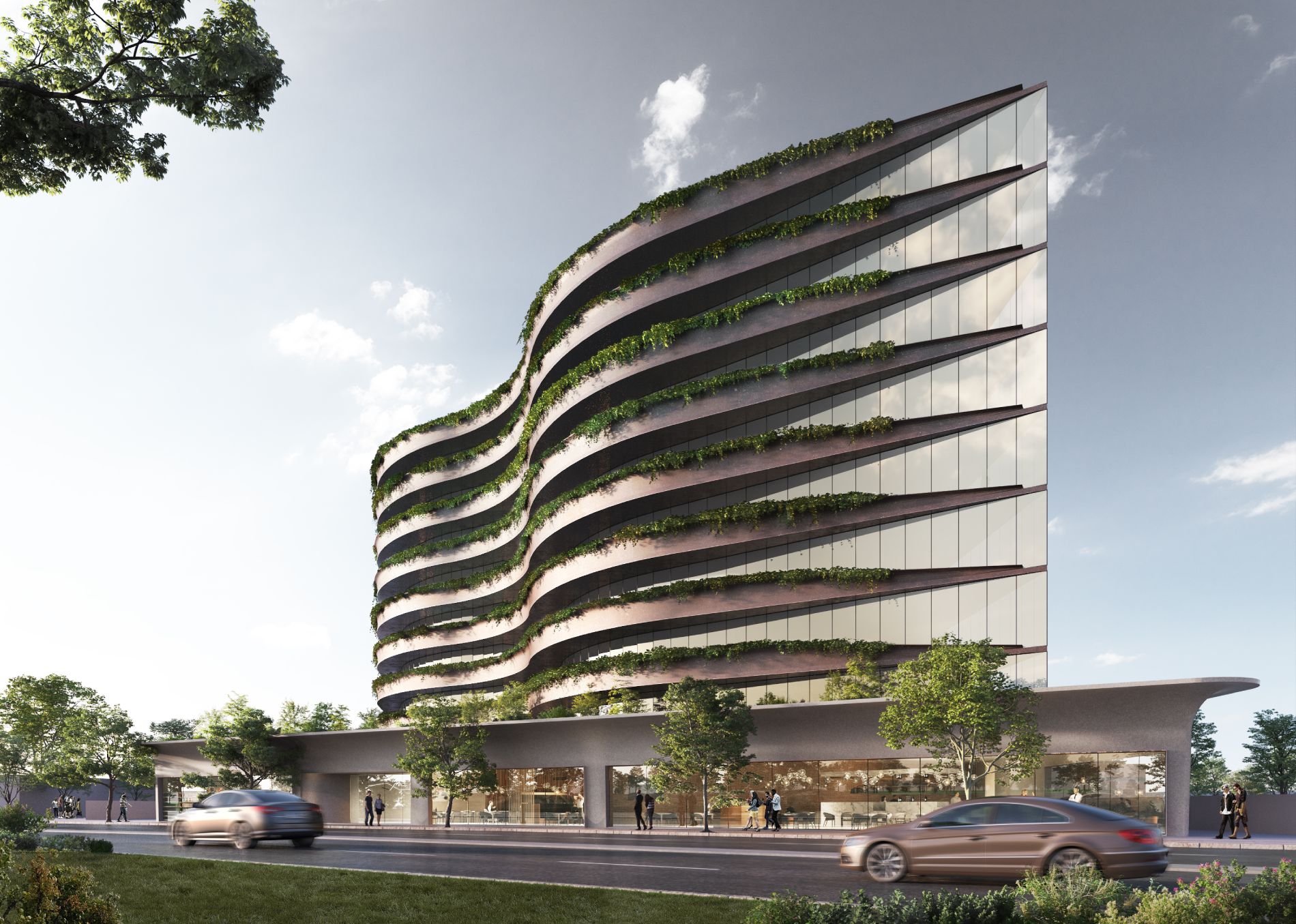
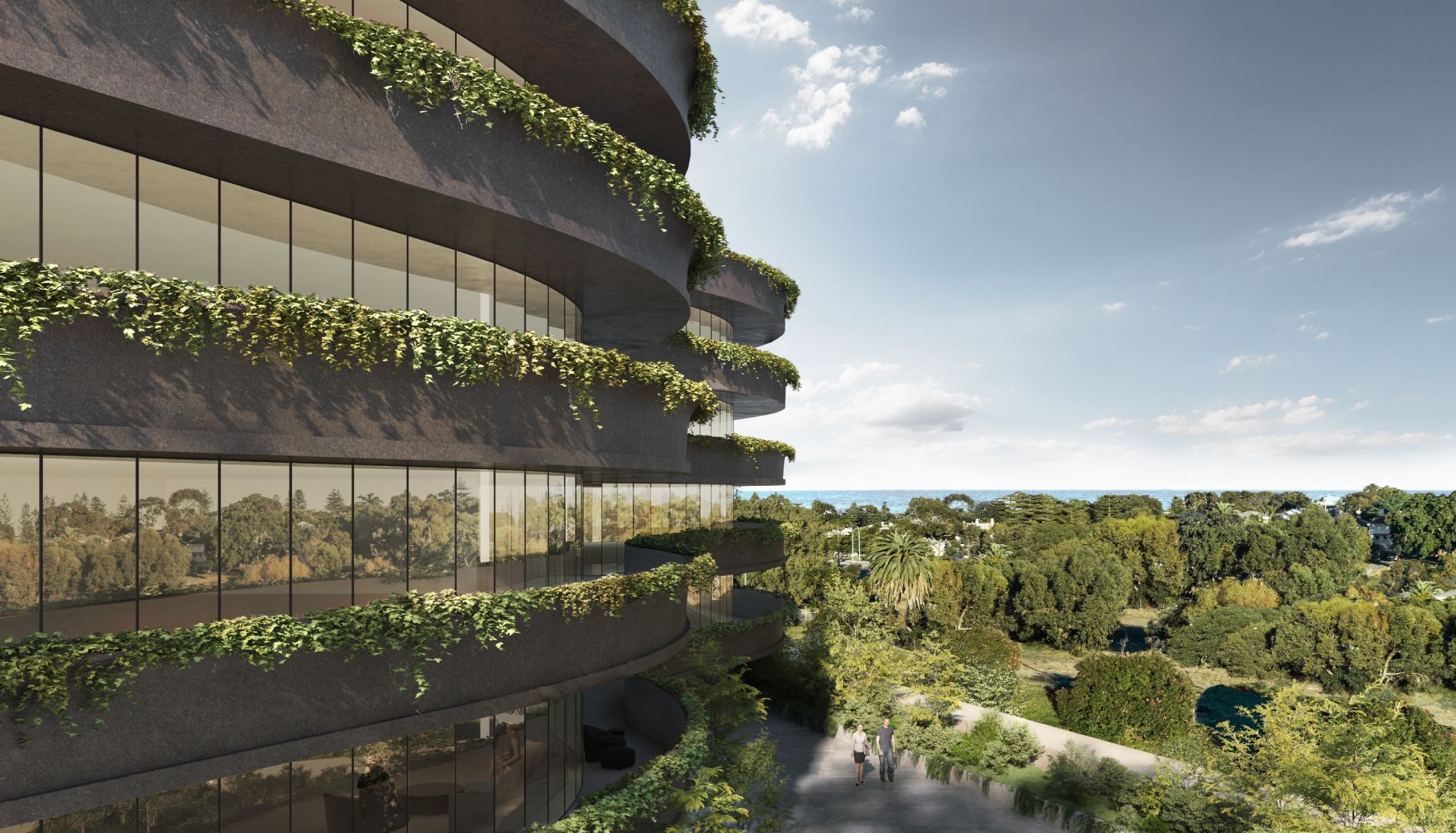
Yield
As per the schematic drawings, commissioned by Elenberg Fraser architects, the determined yield was for a mixed-use development which included retail tenancies at the ground floor level facing Stirling Highway and residential apartments within the levels above provided a yield of 80 apartments and 8,691 square meters of Net Saleable Area. Car parking is provided via a two level basement, with vehicle access occurring via a single crossover on Harburn Mews at the eastern end of the site.
Status
At present the property provides a holding income and is retained by Grange.