373-375 Nepean Highway, Frankston
373-375 Nepean Highway, Frankston
Rezone + Landbank: 373-375 Nepean Hwy Frankston – 194 Apts 14,000 SQM of NSA – Purchased as C2 Rezoned – Landbank.
Site Background
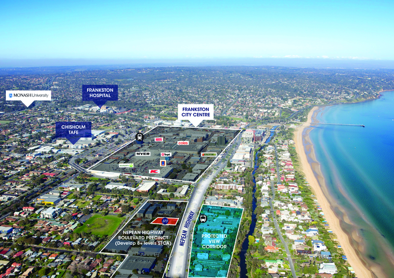
Located in Frankston, some 41 kilometres south-east of the Melbourne CBD, the site is located on the eastern side of the Nepean Highway, approximately 60 metres north of the intersection of O’Grady Avenue and Nepean Highway.
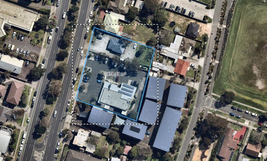
This site (as shown at Figure 1 below) is comprised of two parcels and is generally rectangular in shape. It has a street frontage of approximately 63 metres to Nepean Highway, a depth of approximately 55m (at northern Boundary) and a total site area of approximately 3,418 sqm.
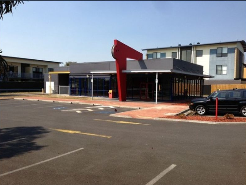
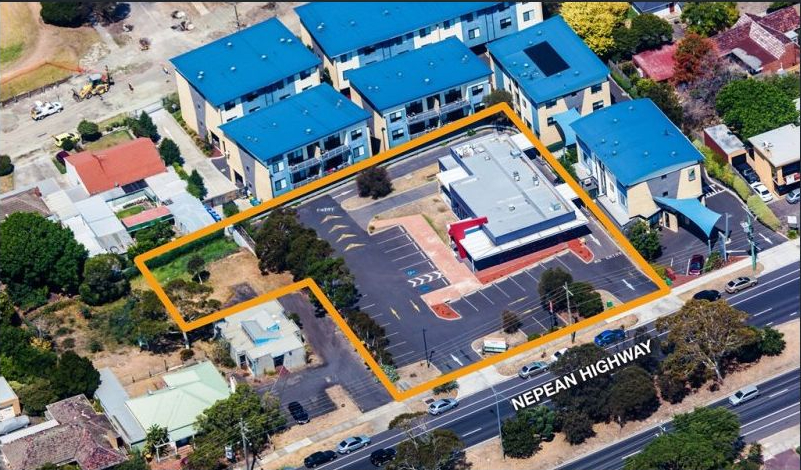
The site is occupied by a single storey medical clinic (at no 375) and medical suites (at no. 373). The site was purchased in April 2018 being leased at the time of the acquisition providing a holding income.
Planning
The site is located at the periphery of the Frankston CBD, approximately 550 metres north-west of the Frankston Railway Station and 320 metres east of Frankston foreshore. Surrounding land uses along Nepean Highway are predominantly low scale and commercial in nature (serviced apartments, motels, medical and allied health services etc). Adjoining land to the south and east is occupied by Quest serviced apartments. The existing low scale nature of development in this area was largely a result of the Commercial 2 Zoning (which does not permit residential land use) and an existing Design and Development Overlay (DDO6) which limited development in the area to a mandatory maximum height of 12 metres.
Frankston was designated as a Metropolitan Activity Centre (MAC) under the State Governments Metropolitan Strategy, ‘Plan Melbourne’. ‘Plan Melbourne’ encouraged MAC’s to develop as major hubs of activity with a diverse range of jobs, activities and housing for their subregional catchments. As a MAC, the scale of development that may be expected in future is likely to be on par with other designated MAC’s such as Footscray, Ringwood and Dandenong.
In 2015, Frankston City Council adopted the ‘Frankston Metropolitan Activity Centre Structure Plan’ (FMACSP), which identified this site and adjoining land along Nepean Highway as a location for mixed use development including ‘commercial activities, offices and higher density residential buildings’. The Structure Plan proposed to rezone the area from Commercial 2 Zone to Mixed Use Zone with a new discretionary height limit of 26 metres.
Council subsequently sought authorisation in 2017 to prepare Amendment C124 to implement the FMACSP for areas peripheral to the city centre. Amendment C124 sought to rezone the site and adjoining land from Commercial 2 Zone to Mixed Use Zone with a new Design and Development Overlay 5 (DDO5) that includes a discretionary 26 metre height limit.
Amendment C124 was gazette by the Minister for Planning and came into operation on 20 September 2019.
Yield
As per the schematic drawings, prepared by local architect Joseph Diaz, the determined yield was for a mixed-use development which included retail tenancies at the ground floor level facing Nepean Highway and residential apartments within the levels above provided a yield of 194 apartments and 14,000 square meters of Net Saleable Area. Car parking is provided via a two level basement, with vehicle access occurring via a single crossover on Nepean Highway.
Status
The property provides a holding income and is retained by Grange.