2131 Romsey Road and 90 Sheehans Road, Romsey
2131 Romsey Road and 90 Sheehans Road, Romsey
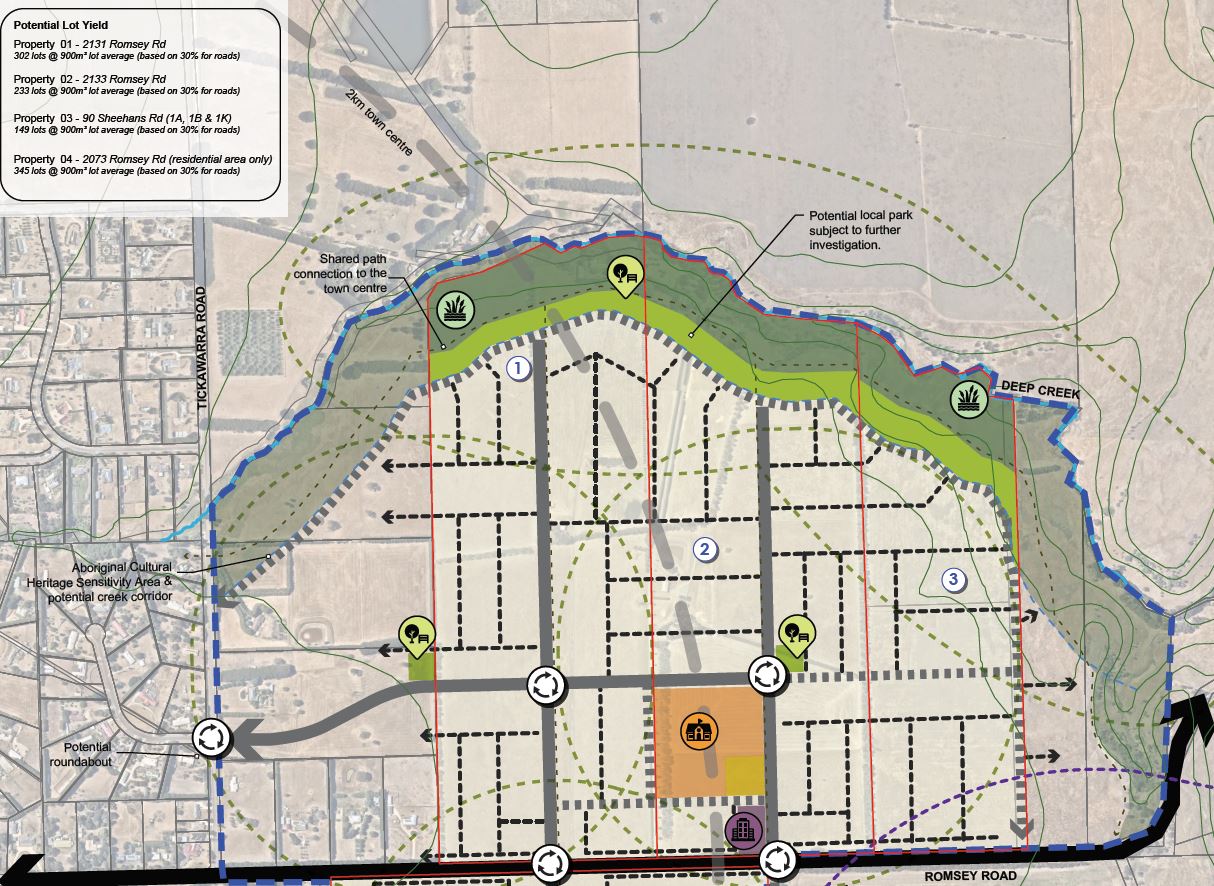
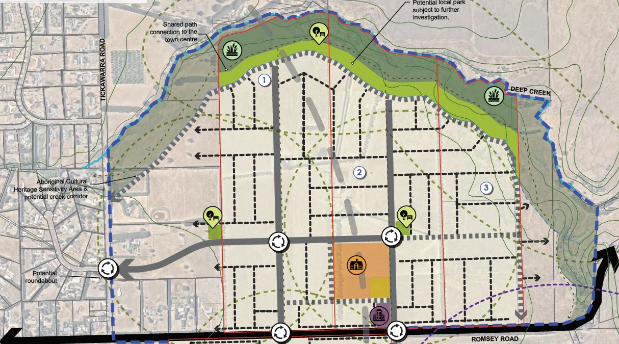
Rezone + Development: 2131 Romsey Road and 90 Sheehans Road, Romsey – 66HA 451 Lots – FZ to GRZ – Rezone Pending.
Site Background
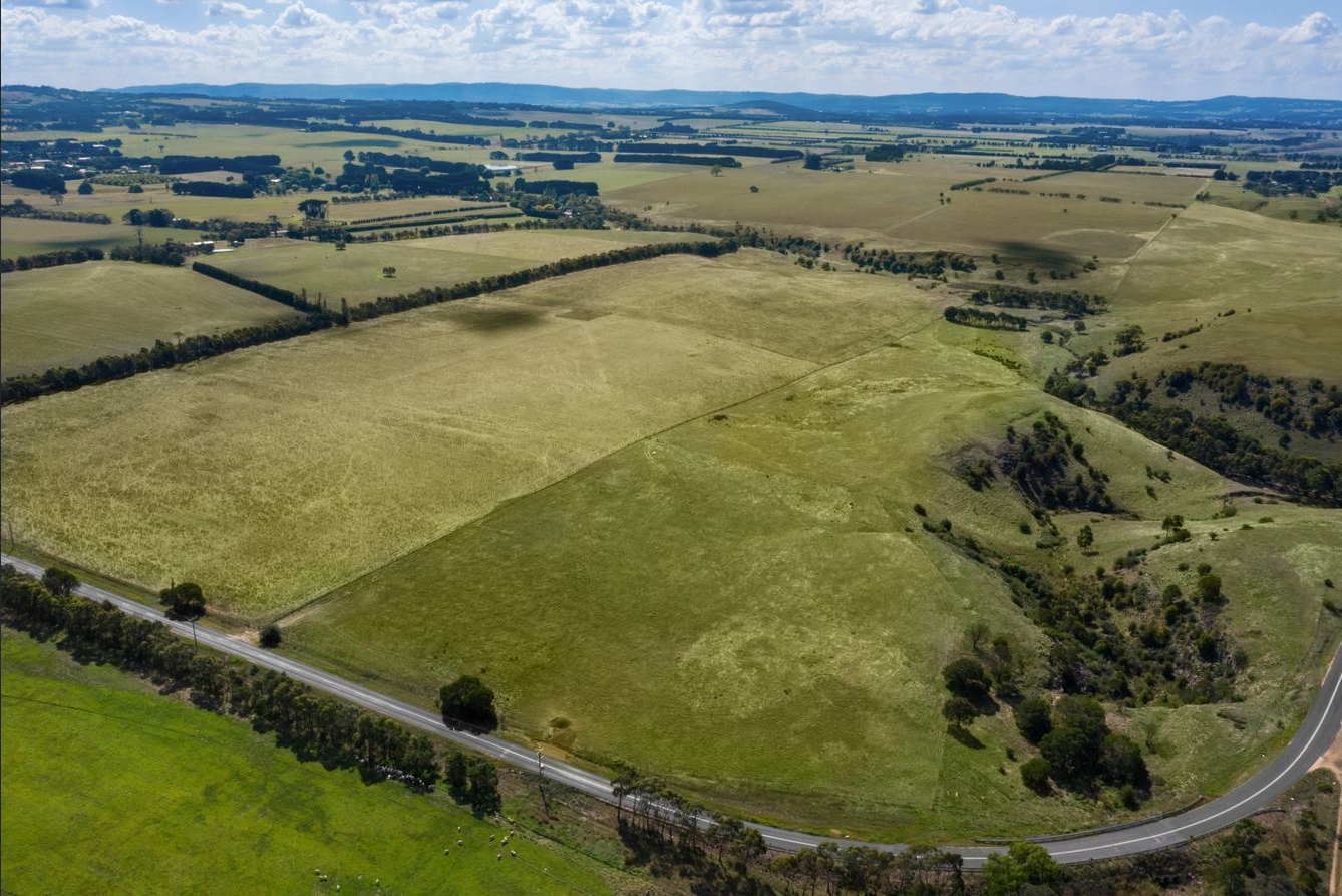
The properties comprise of two separate landholdings totaling approximately 66 Hectares, both being slightly irregular shaped, near level holdings positioned on the northern side of Romsey Road, in the outer northern suburb of Romsey, within the Macedon Ranges Shire, some 61 kilometers from the Melbourne CBD.
The Romsey township has strong links to Sunbury and Melbourne and is experiencing increased growth and development pressure. This is primarily due to the town’s proximity to Melbourne (Approx. 1 hour) and attractiveness to retirees and rural ‘lifestyle’ commuters.
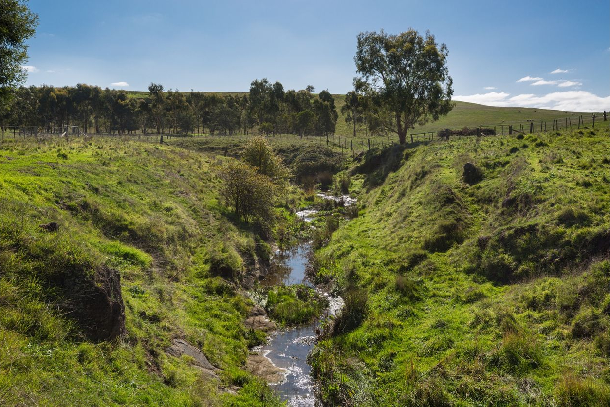
The sites are located approximately 1,500 metres east of the Romsey Town Centre, zoned Rural Living Zone and used for farming purposes (grazing). Improved on 2131 Romsey Road is a single level dwelling with ancillary shedding located to the northern boundary of the site. The sites are generally flat and clear of vegetation although traversed by a tree line with a dam and further shed adjacent to this. The sites adjoin farming land to the north (separated by Five Mile Creek), farming land to the east and smaller farming properties/lifestyle blocks to the west.
The sites were purchased in November 2020.
Planning
The Macedon Ranges Shire Council prepared the Romsey Outline Development Plan (ODP) in 2009 to provide a detailed plan for the future residential, commercial and industrial growth of Romsey, with a planning horizon to 2021. Further future projections in regards to population growth and future town expansion to 2031 were also highlighted however this report did not intend to define the direction for growth beyond 2021.
Although the intention of the ODP was to define a 15 year land supply through to 2021, the long term future of Romsey, post 2021, was also considered by the Settlement Strategy for the Shire. The following was indicated in regards to the east, in which the subject property is located.
“The area east of Tickawarra Road and north of Romsey-Wallan Road would be the closest to the town centre, still a potentially walkable distance given the flat topography of the Romsey-Wallan Road. It would be very well positioned for access to Romsey Park and the primary school.”
From July 2011 through to February 2020 a number of further planning documents directly relating to Romsey and the Macedon Ranges Shire Council were released providing guidance on Romsey’s Growth, character and supply and demand.
By December 2018, the Romsey Issues and Opportunities Paper was commissioned for the purpose of identifying and detailing planning issues and opportunities for Romsey which would help more detailed strategic analysis and prepare an emerging options paper. This is the first stage of the process in preparing a structure plan for Romsey Township, which will ultimately provide a long term vision for the town and determine the long term settlement boundary.
Post acquisition, in December 2020, we commissioned research on Romsey’s current land supply which was completed by greenfield market experts Research 4 which determined Romsey has less than two years available land supply.
Yield
As per the Urban Structure Plans, commissioned by Beveridge Williams, the determined yield was for a residential development providing a yield of either 451 allotments, reflecting an average lot size of 900 sqm or 624 allotments, reflecting an average lot size of 650 sqm. The masterplan for the development includes a local park abutting Five Mile Creek and Government School site.
Status
The property currently provides a holding income and is intended to be developed post gaining rezone and development approval.